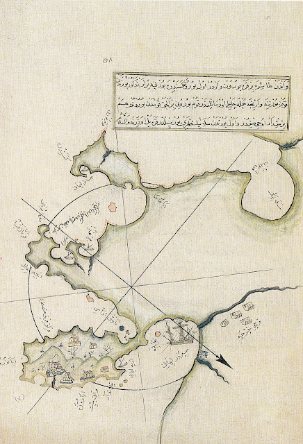
Athens.
All images are taken from
All images are taken from
Piri
Reis and His Charts
by
Mine Esiner Özen (1998).
The
most down-loaded images in several years on Surprised by Time are two I used here from Piri
Re'is -- Crete and the Argolid , so I am offering today a collection of his images of Greek
ports, from a Kitab-ı Bahriye edition of 1521. Note
that whatever the orientation of the map, a heavy arrow usually points
North. Perhaps a reader will be able to explain the variations.
Agia
Mavra
Agion
Oros
Chios
Lesbos
Naxos
Samos
Rhodes
Rhodes-Marmaris
Nauplion,
green coastline, Argos lower left, extant river of Lerna
at bottom. Chesepritri just above red circle.
at bottom. Chesepritri just above red circle.


No comments:
Post a Comment
I will not publish Anonymous comments.